Greenland and Iceland
A Changing Landscape
Our Plan
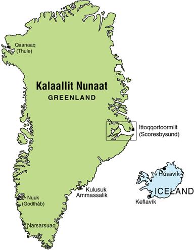
Our next adventure begins this July - sooner than we think with how quickly time passes. Julia and I, along with our friends Cindy and Donald, will spend a month exploring Greenland and Iceland.
While we've all visited Iceland's coastal areas before, this trip will take us deep into the country's interior. But first, we'll fly to Greenland to sail along its remote eastern coast, with Scoresbysund as our ultimate destination.
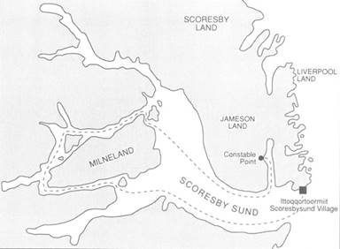 Scoresbysund
Julia and I once sailed within 10 miles of Greenland's coast but couldn't land due to icebergs blocking the shoreline. This time, we're determined to set foot on this frozen landscape.
Almost Greenland
We'll sail aboard the Donna Wood, the newest addition to North Sailing's fleet. This beautiful two-masted oak ship was built in 1918 as a lighthouse vessel but was fully restored in 1990 with sails and rigging. With space for 24 in the deck saloon and comfortable cabins below, she's perfectly suited for our journey.
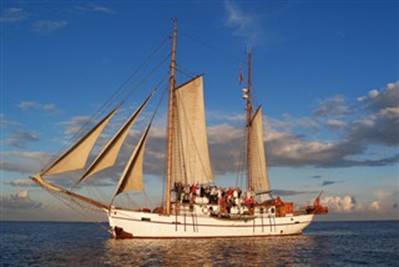 Donna Wood
Our Itinerary:
July 14: San Francisco to Seattle
We'll fly from San Francisco to Seattle, the only West Coast city with direct flights to Iceland.
July 15: Leave Seattle for Iceland
July 16: Arrive Reykjavík, Iceland
July 17-18: Tour Reykjavík
 Reykjavík
As Iceland's capital and oldest settlement, Reykjavík offers a fascinating mix of history and modern Nordic culture. We plan to visit some of the city's famous geothermal spas.
July 19: Fly to Greenland
The 1 hour 40 minute flight takes us from Reykjavík to Constable Point, where we'll board our ship with limited luggage (20kg checked + 8kg carry-on).
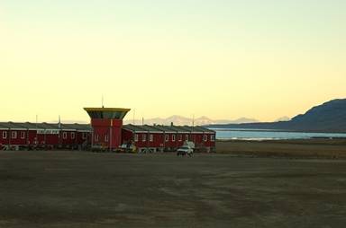 Constable Point in Greenland
From the airstrip, we'll transfer to our ship via zodiac after receiving our expedition gear. Our first stop will be Ittoqqortoormiit, possibly the world's most isolated village.
What to Expect Onboard:
• Comfortable but cozy accommodations
• Three meals daily plus snacks
• Limited shower facilities (water conservation is crucial)
• No internet or cell service except near settlements
• Temperatures between 2-12°C (36-54°F)
Packing Essentials:
• Layered cold-weather clothing
• Waterproof outer layers
• Sturdy hiking boots
• Camera equipment
• Sun protection and bug repellent
Daily Highlights:
July 20: Sail through Scoresby Sound
We'll navigate past breathtaking iceberg palaces before anchoring at Hekla Havn, site of an ancient Inuit settlement.
July 21: Fohnfjord Passage
Between Gaseland's basalt mountains and Milne Land's granite cliffs, we'll witness some of the journey's most spectacular scenery.
July 22: Harefjord Exploration
A full day ashore searching for muskoxen and Arctic wildlife, capped by a beachside BBQ.
July 26: Return to Iceland
After breakfast and farewells, we'll fly back to Reykjavík to begin our Icelandic overland adventure.
Icelandic Highlands Exploration:
July 28: Gullfoss
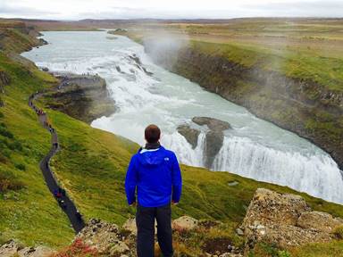 Gullfoss
This iconic waterfall plunges 105 feet in two dramatic stages, with summer flows reaching 4,900 cubic feet per second.
July 29: Kerlingarfjöll
These colorful rhyolite mountains showcase Iceland's volcanic beauty with hot springs and mineral-rich landscapes.
Aug 1-5: Northern Iceland
Exploring Mývatn's volcanic wonders, Dettifoss (Europe's most powerful waterfall), and the charming town of Húsavík.
Aug 11: Return Home
After this incredible month-long adventure through some of Earth's most dramatic landscapes, we'll head home with memories to last a lifetime.
Greenland with North Sailing
Stay tuned for updates from our Arctic adventure!