Watertown, Bar Harbor
Flying the Edge of America
Thursday, August 07, 2008: Watertown, New York
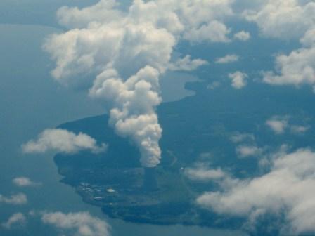
 Could it be this power plant is generating all the clouds?
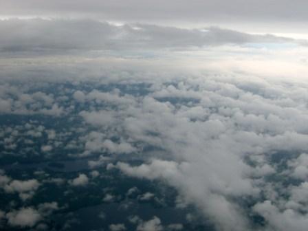
We were scheduled to fly to Swanton-Franklin, Vermont, but thunderstorms limited our flight today to Watertown, New York. So we were able to make some progress on our quest. The flight was filled with rain showers and cumulus clouds, but nothing that hindered us. We landed without incident and were soon picked up by the hotel shuttle, which was driven by two sweet elderly women. They told us they had been working at the hotel for 21 years and shared many other stories of local interest.
We went for a walk after settling into our hotel room, but there just isn't much to Watertown. It seems to be one main road with a few grocery stores and one or two strip malls. Late in the afternoon, thunderstorms tore through the region with heavy rain, thunder, and lightning. I am concerned about our next flight tomorrow as we head further northeast into more remote areas.
Watertown Flight Video
Friday, August 08, 2008: Bar Harbor, Maine
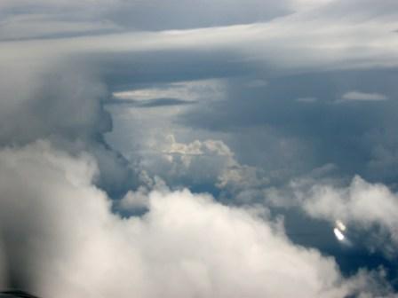
 Somehow this menacing sky holds a strange beauty.
What a day this was. First thing in the morning, we had to decide whether to fly or not to fly. The weather had been horrid since yesterday—thunderstorms, rain, wind, and lightning. We only missed hail, sleet, and snow. I am not impressed with the weather on the East Coast; give me California or Australia any time.
Here was our thought process this morning.
The weather is terrible. Should we fly or stay in Watertown, which is equally terrible?
- We were scheduled to fly to Frenchville, Maine, in the far northeast corner of the USA.
- There is nothing in Frenchville, just a bunch of anglers and deer hunters.
- If we were to fly further northeast, we would not see the terrain anyway because it is so cloudy.
- The weather is horrible and will be for several days throughout the area.
- The place we really wanted to visit in Maine is Bar Harbor because of the National Park.
- The weather in Watertown is marginal but flyable.
- The weather in Bar Harbor is very marginal with a 400-foot cloud ceiling.
- There are no thunderstorms between Watertown and Bar Harbor.
- We are equipped with satellite near-time weather updates.
- There are many places we might be able to land if we have to.
- The terrain is higher but nothing to worry about.
Decision: Let's go to Bar Harbor.
 It was good to find a hole through the clouds.
So we left for the airport at 9:00 a.m., packed the plane, and checked it in the pouring rain; then blasted off into the foggy, rainy, cloudy skies over Watertown. I had plotted a course that took us north towards the border and then east to avoid the lightning in the area. The weather was as predicted—lots of cumulus clouds with several cloud layers below and above us, and rain, lots of rain. The three-hour flight consisted mainly of dodging towering cumulus cloud blocks and being beaten by the rain. We had two powerful weather fronts to punch through. The first gave us 20 minutes of whiteout and jostling, then a clear path between the layers of clouds.
 A happy Julia with her feet on the ground in Bar Harbor.
The second was minor in comparison. The landing at Bar Harbor was not; it was extreme. The instrument landing has a 290-foot minimum altitude, which is the altitude you must be able to see the runway at or abort your landing. As we glided down the approach, I saw 1,000 feet, 800, 500, and then 400 feet go by before the runway appeared with its approach lights flashing and its welcoming tarmac.
We soon had 51-Juliet put to bed, the rental car arranged, and were heading for our hotel in Bar Harbor, where we had several glasses of wine at lunch to celebrate turning our second corner on this amazing voyage around the USA.
Bar Harbor Video
Saturday, August 09, 2008
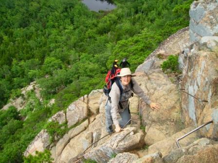
 Julia scampering over the rocks.
We had a fabulous hike in Acadia National Park today. The weather even cleared up a bit for us, and the sun peeked out from behind the clouds. The terrain in Acadia is very different from everywhere else we have hiked so far in America. There is granite here like in South Dakota, but the granite is pink.
However, granite is the only similarity. The trees are a mix of small pines, maples, and other deciduous trees. There were blueberries and huckleberries growing wild all over the place. Julia and I ate many blueberries as we hiked up two of the peaks on the Beehive trail, Mt. Champlain (1,058 ft.) and Mt. Gorham (525 ft.), then walked back to our car along the beachfront trail. The things they call mountains here pale into insignificance compared to the mountains in the west. Sorry, I just had to add this. Julia and I live on a hill in Oakland that is at 1,400 feet. But Acadia National Park is stunning.
 Julia looking very cute.
From Julia: Acadia National Park is a beautiful place on an island in the Atlantic. We hiked in the park for 10 miles today. We climbed up a steep hillside and saw the ocean. We talked about how amazing it was to see the Atlantic. David didn't think we'd make it this far on the trip. We thought back to our visit to Cape Flattery on the westernmost point of our journey and how far we'd made it from that point. We are almost halfway on our planned trip.
Acadia seemed very safe compared to other parks we'd been to. There was no threat of grizzly bears or other malevolent wild critters. No starving mosquitoes licking their lips on our arrival. The path we followed was rocky with pretty pink granite, and there were blueberry bushes all around. It was amazing to eat wild blueberries as we walked. We checked with a family we met along the way that they were indeed blueberries, and the mom assured us they were. She got her kids to stick out their tongues to show us how blue they were so we'd know the berries were safe to eat. We are only here for a day, and we both decided we would love to come back to Acadia. It's amazing to think that on this whirlwind trip around the edge of America, we are flying to each place for only a day or two, and yet it's taking us three months to complete the whole thing. What a huge country this is!
Hike Video
Trip stats
Obama: 14
McCain: 2
Undecided: 2
Miles Hiked: 135
Miles Flown: 4,989
States Visited: 15
Towns Visited: 22