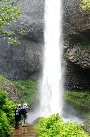
Columbia River Gorge
Waterfall City

Lush rainforest and waterfalls
The Columbia River Gorge began forming during the Miocene Era, approximately 12 to 17 million years ago, and continued evolving through the Pleistocene, between 700,000 and 2 million years ago. During this period, the Cascade Range took shape, shifting the Columbia River’s delta roughly 100 miles (160 km) north to its present location. While the river gradually carved through the landscape over time, the most dramatic transformations occurred at the end of the last Ice Age when the Missoula Floods carved the gorge’s steep, majestic walls.
Today, the Columbia River Gorge is a breathtaking paradise of cascading waterfalls and lush rainforest. While its falls are not the largest in the world—Victoria Falls in Southern Africa holds that title, with Brazil and Argentina’s Iguazu Falls as a close second—nor the most famous in the U.S., an honor belonging to Niagara Falls, they are among the most stunning and accessible waterfalls on the planet.
Most of the waterfalls in the Columbia River Gorge are accessible via hiking trails, allowing visitors to experience the beauty of the rainforest firsthand. Whether you prefer a gentle, flat stroll or a challenging climb to the source of the falls, there is a trail for everyone.
Here is a list of waterfalls you can explore at the Columbia River Gorge:
If you have never witnessed the Columbia River Gorge, make it a priority. Missing this natural wonder is missing the experience of a lifetime.