Gatlinburg, Smoky Mountains, Appalachian Trail
Flying the Edge of America
Saturday, August 30, 2008: Gatlinburg, Tennessee
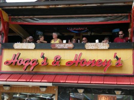 In Tennessee, people like to relax. This reminds me of a photo we took in Thailand.
Rugged, green, tree-covered 6,000-foot peaks. Fast-flowing rivers. Black bears wandering the thick forest. This was our vision of the Smoky Mountains, and this may yet be so, but no signs of it so far. In fact, on our way to Gatlinburg, Tennessee, we passed through Sevierville. We experienced the longest traffic jam of the trip so far.
Sevierville is a cross between Las Vegas and Sunday school. We saw digital billboards advertising Broadway musical-style biblical shows, with showgirls no less. Also, just down the road is Dollywood, an amusement park based on Dolly Parton; it must have huge - roller coasters.
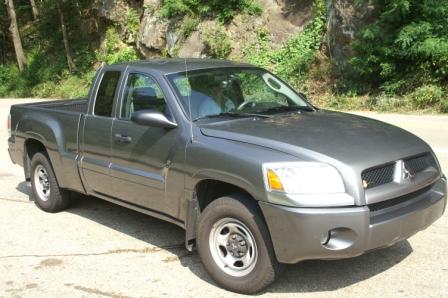 They rented us the smallest car they had.
We finally reached Gatlinburg in our rented pickup truck; it was all they had at the airport.
It took almost as long to drive from Sevierville to Gatlinburg as it did to fly from Kitty Hawk, North Carolina, to Sevierville. Gatlinburg is closer to the mountains but seems to be a big tourist spot too. The good news is our hotel is fine, and I guess we will have no problem finding BBQ or ribs for dinner tonight. Yee-ha!
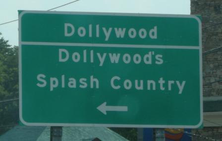 We knew we had arrived when we saw this sign.
This evening we drank a wonderful bottle of Zinfandel before we went out to dinner. So when we arrived at the restaurant, we were both well-lubricated. At dinner, we continued our overconsumption of alcohol and were feeling high. We met a beautiful couple, Suzanne and Amy, at the bar.
They are from Georgia and were really friendly to us. We shared travel stories, and I do remember teasing them relentlessly, but they were very tolerant of my jibes. This is what happens when you have one too many drinks.
Flight to Tennessee
Sunday, August 31, 2008: Smoky Mountains
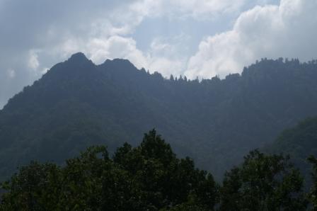 The Smoky Mountains.
We drove into the Smoky Mountains National Park and we did indeed find rugged, green, tree-covered 6,000-foot peaks, fast-flowing creeks, and a black bear in a tree. It is a beautiful place, and the mountain air is smoky (or misty), which is where they get the name from, I guess.
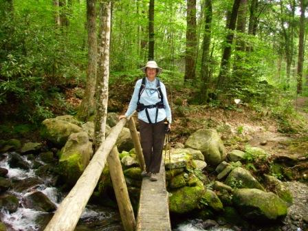 Julia at the bottom of our hike. It was all uphill from here and downhill for me.
We got a trail map and planned what we thought would be a great loop walk on the Appalachian Trail. The walk was long, 14 miles, but nothing we had not done before. The problem was our map did not have topographical information, and our loop walk caused us to descend and ascend 2,000 feet or more! We left the parking lot at 12:00 p.m. and returned at 7:40 p.m. with only a half hour of stops along the way. We were really beat by the ascent, and then I got nauseous (I guess from something I ate), which really made my return unpleasant.
Julia is such a darling. She kept offering to carry my daypack to relieve my load, and finally, I relented after becoming very sick. She would have carried me out if she could have. Anyway, we did make it back, and now that I have had a shower, some rest, and lots of soda water, I feel much better. We bit off more than we could chew (and keep down) on this walk, but it was worth it.
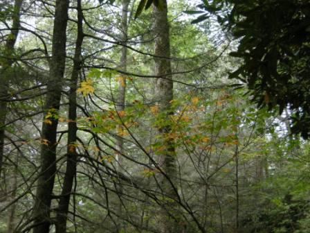 The forest.
From Julia: Despite our hangovers, we set out for the National Park. There are hundreds of miles of hiking trails in the Smoky Mountains, including the Appalachian Trail. We packed our backpacks with water, food, an emergency locator signal device, and spoke to the Park Ranger. We bought a hiking map and then decided on a loop walk. I am not sure why we were stuck on finding a loop, as previous experience has shown us that turning around and walking back out the way you came in is never boring. And it is reassuring in unfamiliar territory. However, we were stuck on the loop idea, and the one we found was particularly appealing as it included a piece of the famous Appalachian Trail. Looking back, I don't think we were very careful about adding up the total miles ahead of us, nor did we take into account elevation gain or air temperature.
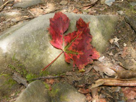 The beginnings of fall.
The woods seemed like a fairy tale wonderland forest. We felt marvelous to be back outside and hiking again. At the first turning in our loop, we descended very steeply down a narrow path on the very edge of the hill. We continued downhill for about two hours. We commented to each other on the unknown uphill ahead. We knew it had to be big, but we weren't scared. We had lunch, looked at the map, and felt fine about continuing on our loop. Once we started our ascent, the day had become much hotter. And climbing uphill heated us up as well. After about 30 minutes, we were feeling very hot indeed. Luckily, we came to a spring of cold water. I knelt down and washed my hands and face, which revived me. I persuaded David to put some water on his face, and then he soaked his hat in cold water. I felt better, but David started to feel very tired as we continued on and on uphill. He was walking very slowly and had to keep stopping. I tried to talk him into letting me carry his pack and his camera to relieve him of weight and help him cool down a bit. He let me take the camera but needed his pack for his water. The hillside went up and up with no respite, and we felt the heat and humidity stifling us. We sat down for a while, and I made David eat a power bar in the hopes that the sugar would help him.
He complained of nausea, and he was worried that he had food poisoning. I worried that he was either dehydrated or overheating and asked him again and again to try and drink and to give me his backpack. He was barely able to continue and looked very pale. We still hadn't reached the ridge. A break in the trees showed me a view of the mountains ahead. It seemed that even once we reached the ridge, there would be lots of up and down ahead. It was terrifying. I looked at the map again and saw that we still had 6 miles to walk, and we were still going up. We turned a corner to see a large bear dropping on the path; the presence of bears seemed nothing compared to David's sickness, so I just stepped over it and carried on. When we got to the ridge and back to the Appalachian Trail, it was encouraging to think that we were on the right path and not lost. But David was staggering and very nauseous. It was now 5:30 p.m., and we had 4 miles to go. We had to make it out of there before dark. David dropped to his knees and vomited. He was feeling terrible. He gave me his pack, and somehow he got to his feet again and kept going. The path was rocky and treacherous. It was another 2 hours before we made it back to the car.
Smoky Mountains Video
Monday, September 1, 2008
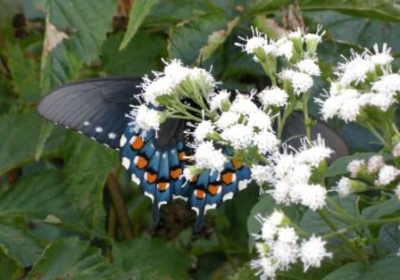 One of the many beautiful butterflies we saw on our walk yesterday.
We spent the first day of fall in Dollywood Splash Park. We figured we could beat the heat by hanging around a pool all day, and it worked. We also wanted to rest up a bit from yesterday's ordeal. It turned out that I did not have food poisoning but rather I had overheated. Given the 90-degree day and high humidity and the long day and the steep climb, I guess this makes sense.
We have discovered that there exists in Gatlinburg a large community of expatriate Russians. We are not really sure why this is, but it does add some extra color to the place.
Tuesday, September 2, 2008
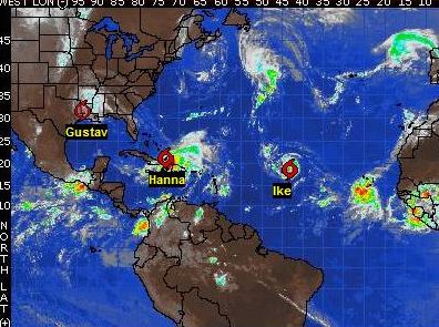 The hurricane outlook on this day.
Last night, we watched the Weather Channel and became very concerned about hurricanes and our planned direction of flight. Hurricane Gustav has now moved inland and is creating some nasty weather in northeast Texas, so turning west right at the moment would not be wise as we would run into the remains of Gustav. On the other hand, Hurricane Hannah is predicted to run up the southeastern seaboard by this Friday.
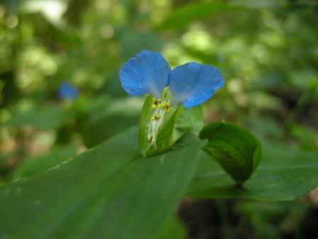 An example of the flora of the forest.
Its exact path and timing is uncertain at this time, but it looks like we could run right into it if we continue with our planned flight southeast down the Florida coast. So Julia and I spent the morning at the NOAA hurricane watch site trying to figure out how we should adjust our plans based on hurricane predictions. It seems unlikely that we will be able to fly down the eastern coast of Florida, as even if we missed Hurricane Hannah, Hurricane Ike (and a yet unnamed hurricane known only as Ten) are predicted to follow Hannah, wreaking havoc in the Florida and Gulf of Mexico areas. So it looks like we will have to turn west earlier than we had planned, but just when I am not sure yet.
Off we went again hiking today in the stupendous Smoky Mountain forest. We made sure the hike was only 5 miles long. I wore shorts and short sleeves today, so this time I did not overheat, and we both had an amazing walk. You know what they say about getting back on the horse. The forest here is really a rainforest, very dense, filled with ferns, mosses, rhododendrons, and vines.
We were to fly to Savannah, Georgia, tomorrow, but Hurricane Hannah has forced us to change our plans. So tomorrow we will make our turn westward and head to Selma, Alabama. This course takes us south of the remains of Hurricane Gustav. It is very disappointing to cut Florida out of our trip, but caution is the better part of valor in this case.
Trip stats
Obama: 20
McCain: 5
Undecided: 3
Miles Hiked: 169
Miles Flown: 6,825
Flights Flown: 31
Hours Flown: 50.80
States Visited: 24
Towns Visited: 40