Antarctic Islands
Exploring
Tuesday, November 20, 2007
It did not seem real that we were nearly at the bottom of the world.
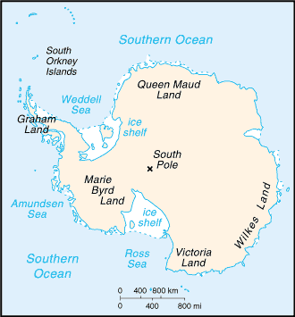
We stopped at what is named on the map below as Graham Land, the tip of the
Antarctic Peninsula. We passed the Shetland Islands and many icebergs on the
way. Once the ship was in the shelter of the Antarctic islands, the ocean
swells reduced, and we were able to get some relief from the high seas we had
experienced on our two-day sail from Ushuaia.
Wednesday, November 21, 2007
The sheer beauty of our frozen world.
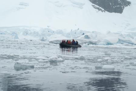
What an amazing day we had today. We boarded the Zodiacs for our first time on land in two days and landed on the
black soil beach of Aitcho Island. The island was covered in snow except for
the beaches and was overrun by penguins.
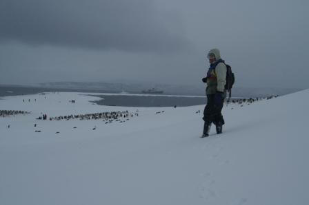
We walked the beach and then climbed the hill in the
middle of the island. From the top of the hill, we could see the beach we
landed on and the beach on the other side of the tiny island. After a few
photos, we walked down the hill to the other beach. There we found many
penguins, icebergs, and seals. The weather was overcast and just below
freezing.
Aitcho Island Video
Was this a big penguin or what?
Once we returned from the morning excursion, we had lunch and then sailed on to
Yankee Harbor on Greenwich Island to spot seals.
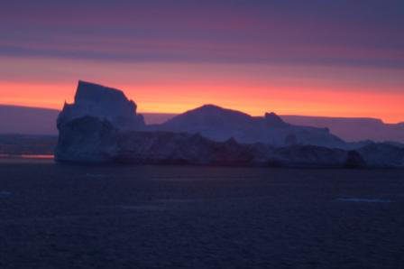
The most spectacular sunsets I have ever seen.
What a magnificent place this was. It is a small island
with most of its terrain about 4 to 6 feet above sea level. In the middle of
the island were several 1,000- to 2,000-foot mountains. The island was dotted
with penguins and seals. Lawrie and I walked the full length of the island,
which turned out to be a three-mile hike.
The island was surrounded by icebergs, some with the most beautiful shades of icy
blue.
Yankee Harbor Video 01
Once we returned to the ship, we set sail to our next
destination and spotted a pod of orca whales along the way. That evening, we
sailed for Astrolabe Island and were privileged to see one of the best
sunsets I have ever seen. This time of year, the sunsets start at 10:00 p.m. and end
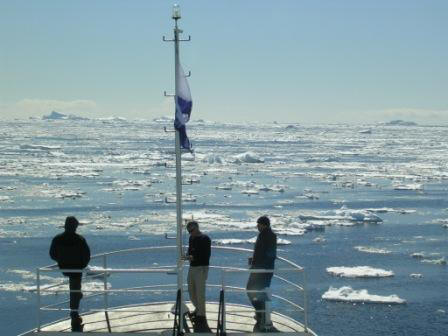
at 12:00 a.m.! We also encountered the beginning of the Antarctic pack ice.
The Captain slowed the ship down and gingerly maneuvered through the ever
thickening sheets of floating ice. It was truly something to experience
and quite unnerving.
Yankee Harbor Video 02
Thursday, November 22, 2007
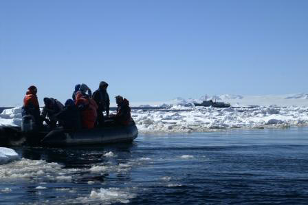
This is as close to pack ice as you'd want to be.
This morning, we took the zodiac boats and circumnavigated
Astrolabe Island. The
stormy weather we had been experiencing since leaving Ushuaia had finally
subsided, and it was very sunny this morning. It was glorious but very
cold.
As we sailed around the island, we saw many penguins
in the water and on the island. The penguins are amazing as they can leap
out of the water up 6-foot cliffs at the shoreline. We saw pack ice from the
bridge of our ship last night, which was spectacular and surreal, but today we
got up close and personal with the pack ice on our zodiac tour of the
island. It was fantastic to peer over the side of the zodiac into the blue,
green, and turquoise waters filled with unworldly ice sculptures.
Astrolabe Island Video
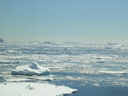
Normally, there would be no ice this time of year.
After lunch, we sailed south to get in position for a
landing on the Antarctic mainland.
We tried to go south via one route that took us closer to the mainland, but we
were turned back due to the unexpected thickness of the pack ice. It's a "Shackleton"
summer this year.
This means the weather is much colder than it normally
is. The situation gets its name from Ernest Shackleton, who got stuck in the
Antarctic in similar conditions. This meant we had to sail south via the
open sea, and of course, we encountered very rough seas once again.
Almost everyone was ill during the afternoon and evening, and I stayed in my
bunk gazing out of my 2-foot porthole all afternoon. I watched icebergs of
all shapes, sizes, and colors go by; it was a very unnerving experience seeing them
pass by your small porthole. As a berg hit the side of the ship, it made a loud scraping sound as it dragged along the hull. I got up at
11:30 p.m. and went to the bridge to see where we were and found that we had
arrived at our planned destination, quite far south of the Shetland Islands.
I went back to bed and slept well that night, cradled by pack ice, islands,
and the Antarctic continent.
Friday, November 23, 2007
It is a frightening place, but its beauty is alluring.
We were woken this morning by a message over the ship's
intercom announcing that another tour ship was sinking and had put
its passengers overboard in life rafts, and that our ship had turned north on
a rescue mission to pick up the survivors!
At first, I could not believe what I had heard. Normally, the message over the
intercom was about a meal being served.
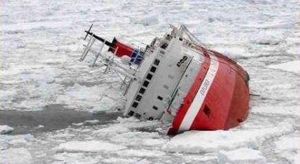
The ill-fated Explorer. Its passengers spent a very
cold night in lifeboats.
I got dressed and headed upstairs to the lounge, where the
other passengers were abuzz with the news. None of us knew much more than
what was said over the intercom, so our imaginations ran wild. We headed into
breakfast, where unsubstantiated stories ran rampant. Did alien penguins from
Mars make a false Mayday signal to lure us to them so they could suck out
our brains? Had Russian submarines crashed into the ill-fated ship? Yes, we are an
imaginative lot.
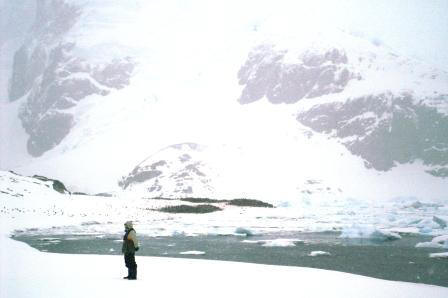
My brother fell deeply in love with this extreme landscape.
After breakfast, we were all summoned to the lounge, where our chief guide explained the situation. It turns out that the tour
ship *Explorer* had struck an iceberg around 2:00 a.m. and was
taking on water. The captain of the *Explorer* decided to abandon ship, and
so the crew and passengers were all onboard life rafts floating near
the South Shetland Islands. Once
the Mayday call was made, all of the other 15 tour ships (except one, which
our guide would not name but we figured out was the *Polar Express*) in the
area turned and headed to the last known position of the *Explorer*.
While on our way to the disaster, one of the other ships
arrived and rescued everyone with no loss of life. So we turned back to our
original heading to continue our trek south. This event really brought home how
remote and fragile we are down here in Antarctica, and how self-reliant we
must be.
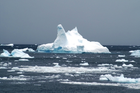
Icebergs were ever-present.
The weather turned bad again this afternoon as we made
our way south, so we were unable to stop at our first planned destination. We
continued heading south, looking for better weather. We finally made it to
the Gerlache Strait and turned in toward the Antarctic continent. The
weather did not clear up—it kept snowing all day.
But the wind did die down a little, giving us some relief from the massive
seas.
We eventually were able to land on Cuverville Island,
which was spectacular. The island has a main beach area where we were to
land in our initial plan, but because the pack ice was so thick and piled up
at the main beach, we landed on another smaller beach. On the island, we found
many penguin rookeries. The snow kept falling the entire time we were on the
island, making the scene very tranquil. Unbeknownst to us, the pack ice was
congealing while we were walking the island, and when we tried to return
to the ship, we found our way blocked by pack ice. The crew used an empty
zodiac boat to chop an opening in the ice, allowing us to return to our
ship. What a great landing this was and how adventurous.
Cuverville Island Video